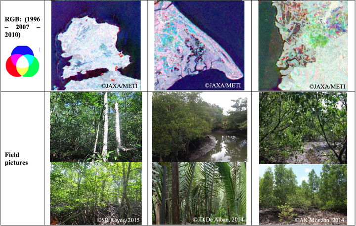
 False colour composite of ALOS/PALSAR images (RGB: 1996-2007-2010) and mangrove field validation sites in the Philippines.
Abstract
Quantitative information on mangrove cover extents is essential in producing relevant resource management plans and conservation strategies. In the Philippines, mangrove rehabilitation was made a priority in relation to disaster risk response and mitigation following the calamities in the coastal communities during typhoon Haiyan/Yolanda; hence, baseline information on the extent of remaining mangrove cover was essential for effective site interventions. Although mangrove cover maps for the country already exists, analysis of mangrove cover changes were limited to the application of fixed annual deforestation rates due to the challenge of acquiring consistent temporal cloud-free optical satellite data over large landscapes. This study presents an initial analysis of SAR and optical imagery combined with field-based observations for detecting mangrove cover extent and changes through a straightforward graphical approach. The analysis is part of a larger study evaluating the synergistic use of time-series L-band SAR and optical data for mapping and monitoring of mangroves. Image segmentation was implemented on the 25-meter ALOS/PALSAR image mosaics, in which the generated objects were subjected to statistical analysis using the software R. In combination with selected Landsat bands, the class statistics from the image bands were used to generate decision trees and thresholds for the hierarchical image classification. The results were compared with global mangrove cover dataset and validated using collected ground truth data. This study developed an integrated replicable approach for analyzing future radar and optical datasets, essential in national level mangrove cover change monitoring and assessment for long-term conservation targets and strategies.