Improved estimates of mangrove cover and change reveal catastrophic deforestation in Myanmar
Abstract
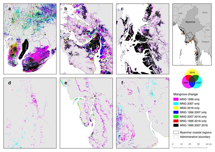
Mangroves are one of the world’s most threatened ecosystems, and Myanmar is regarded as the current mangrove deforestation hotspot globally. Here, we use multi-sensor satellite data and Intensity Analysis to quantify and explain patterns of net and gross mangrove cover change (loss, gain, persistence) for the 1996–2016 period across all of Myanmar. Net national mangrove cover declined by 52% over 20 years, with annual net loss rates of 3.60%–3.87%. Gross mangrove deforestation was more profound—63% of the 1996 mangrove extent had been temporarily or permanently converted by 2016. Rice, oil palm, and rubber expansion accounted for most conversion; however, our analysis revealed targeted systematic transitions of mangroves to water (presumably aquaculture) and built-up areas indicated emerging threats for mangroves from those land uses. Restoration programmes facilitated mangrove gains and represent a critical area for investment alongside protection. This study demonstrates the importance of multi-sensor satellite data for national-level mangrove change assessments, along with gross land cover transition analyses to assess landscape dynamics as well as prioritise threats and interventions in an effort to develop holistic strategies that aim to conserve important habitats.
Jose Don T De Alban
carbon markets | redd+ | nbs | conservation | geospatial | land change | sustainability | Southeast Asia