New project on assessing outcomes in certified community mangrove forests.
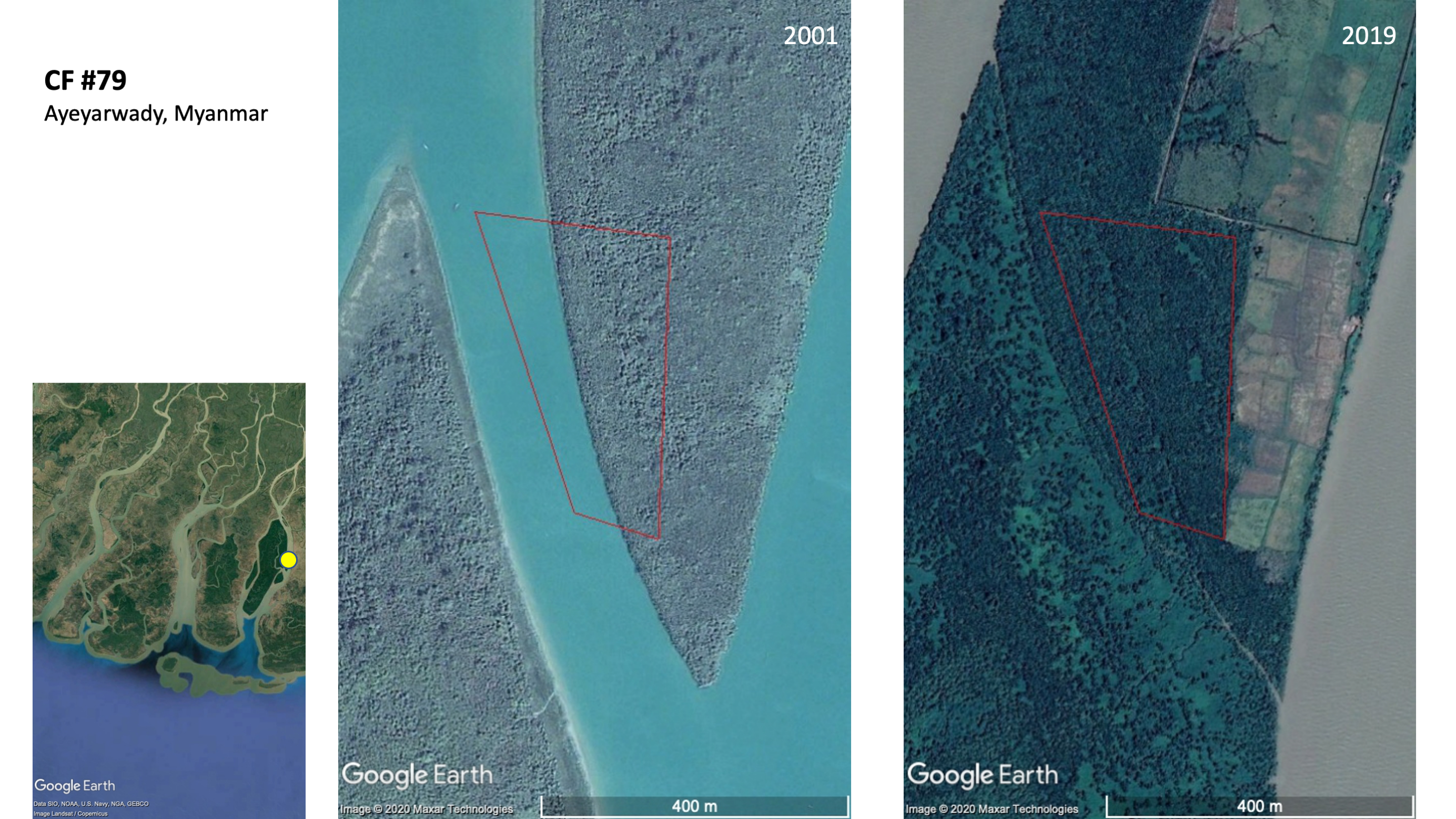 Mangrove accretion around the community forest area in Ayeyarwady Delta, Myanmar over 18 years, as seen from Google Earth.
This month, we started a new research project that aims to track forest cover in certified community mangrove forests in Myanmar and provide information that may improve the process of certification and the policies supporting these forestland tenure activities. Specifically, the project aims to track mangrove forest change in 70 certified community forests of Myanmar, mainly in Ayeyarwady, Yangon, and Tanintharyi Regions. The research team will measure land cover change over time using annual Landsat time-series to quantify the amount of mangrove forest change since the late 1980s. These estimates of land cover change will focus on net and gross mangrove changes, and the transitions of mangrove loss and mangrove gain. The study will include sites that have not been under formally certified community forest management, therefore including counterfactuals to assess whether certified community forests have led to any improvement in the rate of mangrove cover change since the inception of formalised community forest management.
The project is a research collaboration between the Applied Plant Ecology lab at the National University of Singapore, Landesa, and The Center for People and Forests (or RECOFTC). Our lab at NUS will be working on the land cover change analysis using remote sensing technologies, complemented by the team from RECOFTC who will be implementing field data collection and household surveys within these certified community mangrove forests. Landesa provides overall project leadership and funding from its donors for the implementation of the project.
I am happy about this research project because it is a direct outcome of our paper on historical mangrove change in Myanmar that we published in Environmental Research Letters some time in March last year. Landesa’s senior leadership read our paper and initiated conversations with us to explore opportunities to collaborate, which then resulted in this collaborative pilot research project in Myanmar, with the potential to expand in geographic scope across Southeast Asia in the near future.
Read here for more information about the project.
Jose Don T De Alban
carbon markets | redd+ | nbs | conservation | geospatial | land change | sustainability | Southeast Asia