Carbon research mentioned on GovInsider.
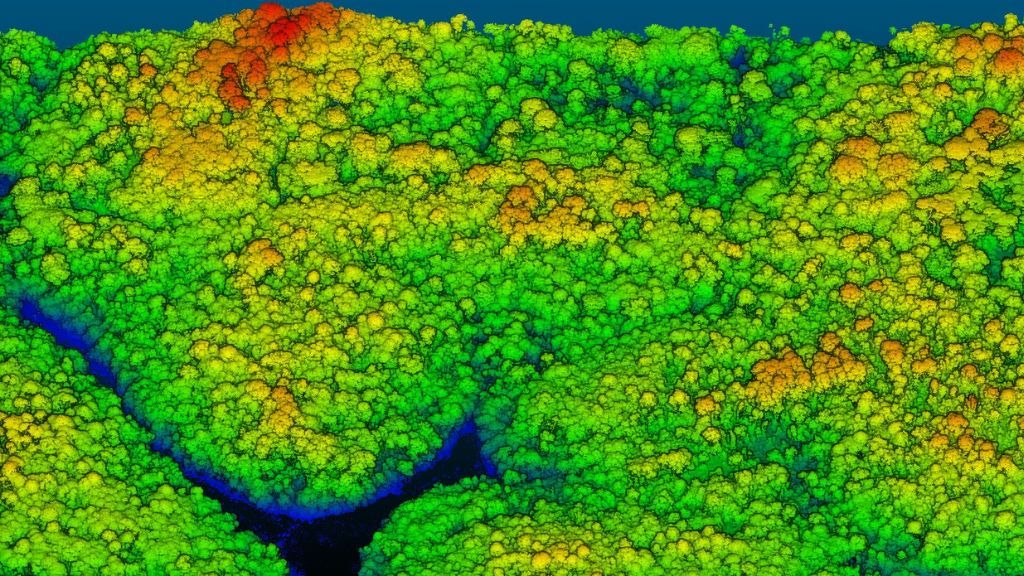 A 3D visualisation of an area of forest using LIDAR point clouds (Source: Singapore Land Authority).
I am happy to share a recent news article on GovInsider that mentioned our ongoing research collaboration between the Centre for Nature-based Climate Solutions and the Singapore Land Authority on improving estimates of the amount of carbon for different forest ecosystems in Singapore using field measurements combined with advanced remote sensing technologies, including Light Detection and Ranging (LiDAR).
GovInsider speaks with experts from the Singapore Land Authority (SLA), the agency spatial data to support and further #climateresearch in the country. 🍃
— GovInsider (@GovInsider) January 12, 2023
Read more here:https://t.co/H2zarKqYDL #SLA #GNSS #climateresilience pic.twitter.com/skMxVlmw4g
I was also quoted based from our interview for the article with Ms Rachel Teng, the author and a reporter and conference producer at GovInsider:
While scientists do possess global estimates of carbon sequestrations, the margins of error in Southeast Asia are significantly large, which may have implications on the reliability of carbon markets on this side of the globe. “If you have large uncertainties for carbon estimates in Southeast Asia, this also translates into investor and price uncertainties,” says Dr Jose Don Tungol De Alban, a researcher at CNCS.
Jose Don T De Alban
carbon markets | redd+ | nbs | conservation | geospatial | land change | sustainability | Southeast Asia